
 Cumberland Island Kayak tours
Group size: 1 – 24 people
Trip length: 6 – 8 hours
Skill level: Moderate (physical ability, endurance and determination are needed)
Cost
Most guided tours are $50 per person. (includes boat, paddle, vest, shuttling and your guide)
Using your Own Boat – $40. (many paddlers with their own boats like to join us to learn more about the history, archaeology and natural history of these rivers).
Dates
Join a scheduled tour (see tour calendar ), or suggest one. Find a free date on the calendar and suggest the trip of your choice. If there are no conflicts, we’ll post it!
OR
Schedule a private tour. Use contact form, email us at riverguide2000@yahoo.com or call (386-454-0611)
Location
Check the River Locator Map or Click the link below for a local map and then use zoom and panning arrows to explore the area. (Note: the marker is NOT our meeting place, but a nearby landmark.
Local Map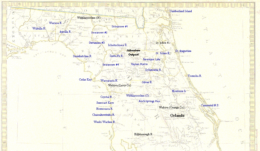
Description
Above all else, its the wonderful sense of mystery that captures your senses as you first stroll onto the brilliant, sugar- sand beaches of Cumberland Island. It hangs thick in the air, overpowering all else like the heavy fragrance of an orange tree in full bloom. Defining the extreme south eastern corner of Georgia, this seventeen mile barrier island is a nature lovers dream.
Perhaps the most amazing thing about this beautiful island is that it remains in a primarily natural state. This, in spite of the fact that people have had their eye on settling here from the earliest days of exploration and settlement. Starting with the earliest days of colonization, when three different Christian missions  were established to convert the natives, Cumberland has always been a much coveted chunk of real estate. Forts were built here, several plantations and even a small town were all located on the island. But none would endure the test of time. Finally, in 1970, it appeared as though civilization was preparing to flood onto the island in earnest, when electric lines were run to the island. But fate smiled on the island once again when Cumberland Island National Seashore was established in 1972.
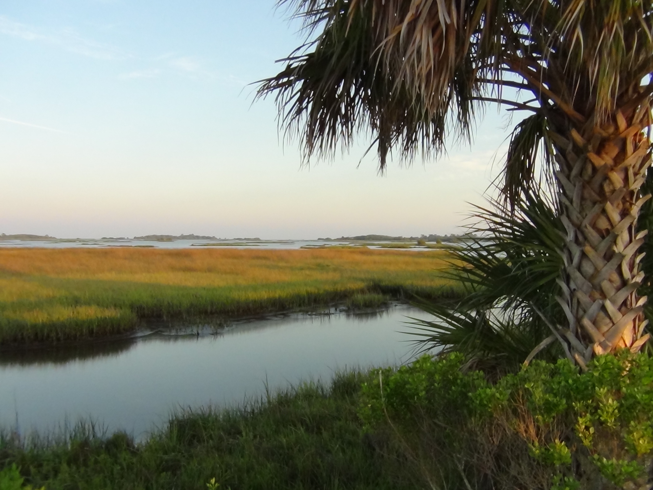
Natural beauty is the hallmark of Cumberland Island. With a variety of well developed habitats, ranging from dazzling, sugar-sand beaches and complex dune systems on the east shore to a vast expanse of salt marshes bounding the island on the west. In the islands interior, a mature maritime forest of live oak and towering pines is interspersed with small, fresh water ponds.
Wildlife
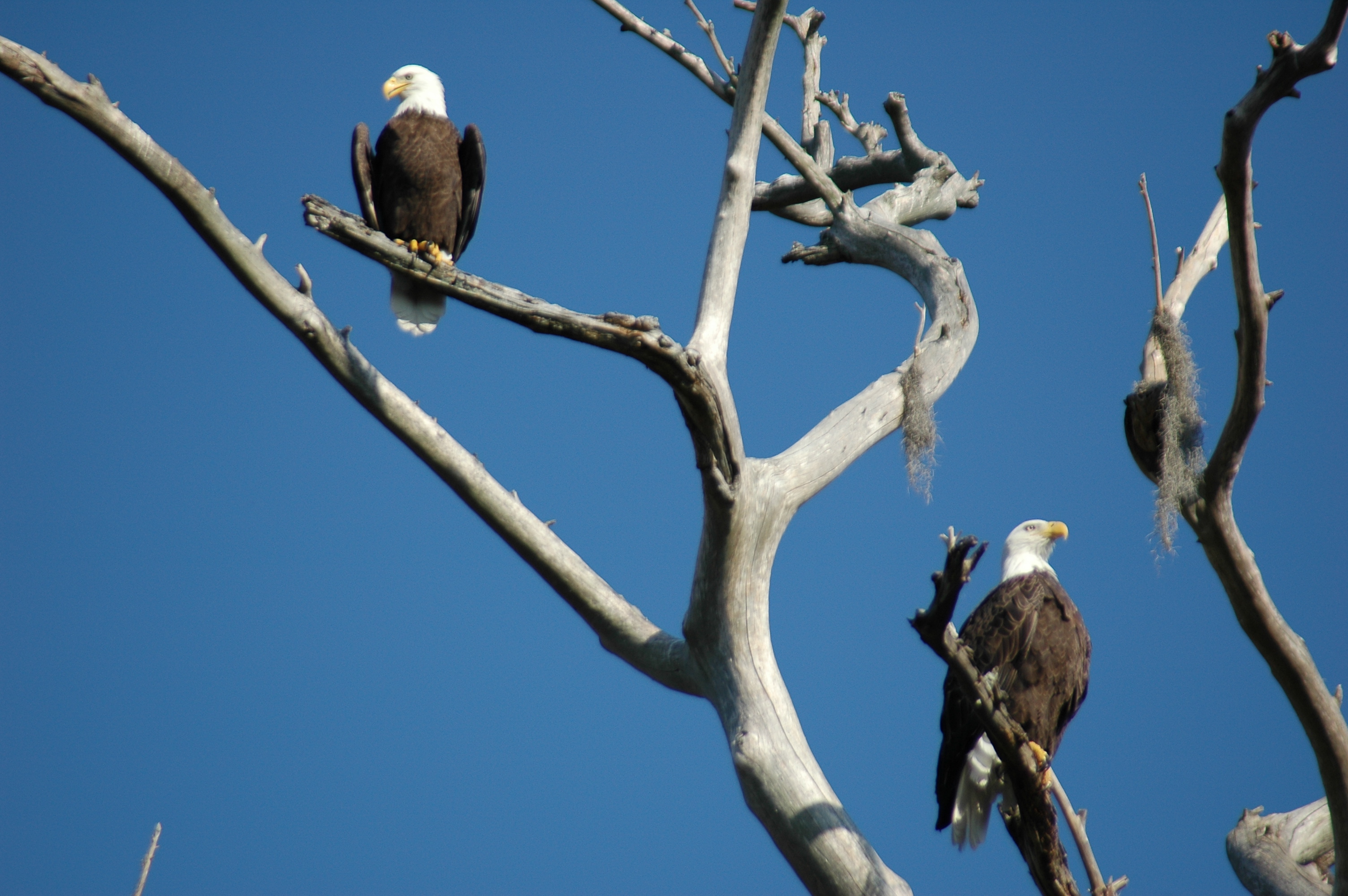
Waders and other shore birds are usually found here in happy numbers. The three primary habitats found here – shore, dune and maritime forest – are all good places for bird watching. Sea turtles nest here, and one often sees dolphins in the surrounding waters. Less frequently seen are whales. Feral hogs, a problem throughout much of Florida are found here. As are about 300 wild horses – released here when Lucy Coleman Carnegie (yeah, that’s the same Coleman you see on your lantern) died in 1916.
History
When Ponce De Leon first sailed passed this way in 1513, the native Timucua Indians referred to their home island as Missoe, which meant “beautiful”. The main village on the island was Tacaturu. As was customary with many Timucua villages, the Chief had the same name.
 In 1566, the first settlement of Europeans was established by the Spanish who called the Island San Pedro. Actually, it was more of a fort than a true settlement. In addition to the 80 soldiers garrisoned at the outpost, there were a number of Jesuit missionaries, determined to bring Christianity to the “heathens.” They were soon run out by the Indians. Nearly twenty years later, more missionaries (this time from the Franciscan order) arrived and built a mission on the southern end of the island. They named it San Pedro de Mocama . Mocama was a Timucua word meaning “salt-water” and referred to the Timucua alliance of villages ranging from Cumberland Island south to the St. Augustine area.
In 1597, local Guale Indians revolted and the mission came under attack, but was successfully defended by the local villagers. Even though the attack was repulsed, Spanish authorities now realized the missions vulnerability and ordered the mission abandoned.
In 1603, the friars returned and rebuilt San Pedro. Over the years, increased English presence and pressure weakened the Spanish hold on the Island. Finally, in 1683, England took possession of the island.
In 1736, James Oglethorpe, leader of the Georgia colony, visited the island. Local chief Toonahowi, who had previously been taken to England where he met the Duke of Cumberland, renamed the island “Cumberland.” Oglethorpe ordered construction of a fort, which they named St. Andrews. The fort was garrisoned with 220 men. Their living quarters were in the adjacent village of Barrimacke. A few years later, they built another fort and named it Ft. Prince William, on the islands south end. Nearby, Oglethorpe built a hunting lodge which he called Dungeness. While this name was likely an homage to a famous headland (blunt peninsula) in England, I have to wonder if it wasn’t partly inspired by the name’s etymological root meaning. Being an exposed point at the very southern tip of English frontier, facing hostile Spanish Florida, this certainly was a “dangerous nose.”
In 1742, St. Andrews was destroyed by Spanish raiders forcing the garrison to concentrate in Ft. Prince William.
In the 1750’s, Cumberland Island was considered neutral grounds between English and Spanish colonies. This made it an ideal location for criminals. By the late 1750’s, the outlaw population, numbering nearly 300, formed the basis for the islands first permanent settlement.
After the American Revolution, in 1783, war hero Nathaniel Green bought Cumberland Island. His intention was to harvest the massive live oaks for their valuable timber (nothing surpassed the curvaceous, strong wood of southern live oaks for ship building). However, he died a few years later before wreaking his intended carnage on the ancient forest. But the forests weren’t completely spared. In the 1790’s, a number of ships were commissioned to combat the rising threat of piracy. Some of the timber used for these new ships was reportedly harvested from Cumberland Island.
A decade after Nathaniel Green’s death, his widow married a cotton farmer named Phineas Miller. Together, they built a tabby mansion on top of an Indian shell midden near the south end of the island. Located near the site of Oglethorpe’s former lodge, they called the mansion, Dungeness.
For much of the 1800’s, Dungeness served as both a popular destination for the social elites of the southern plantation society as well as a military outpost. It burned down in 1866.
In 1884, Thomas Carnegie, brother of mega-millionaire (and philanthropist extraordinaire) Andrew Carnegie built another mansion on top of the Millers old plantation. He, too, kept the name Dungeness. It was a monstrous mansion, with a golf course and swimming pool, attended by 200 servants. The family lived there until the Depression, at which time they vacated the mansion. In 1959, it was destroyed by a fire, presumably set by a disgruntled local who had recently been shot in the leg when he was found poaching on the property.
The remains of the Carnegie’s Dungeness are still standing, still an interesting place to explore and ponder the island’s rich history. On this one site, you’ll see evidence of the Native American occupation that spanned many centuries and a long legacy of Europeans, settlers and entrepreneurs of all of many backgrounds who tried to conquer this island’s wild heart–and failed. Exploring Cumberland Island (with the exception of a few isolated corners), it’s clear that nature is in full control of this natural wonderland.